Way of St. James from Sarria
Live your first experience on the Pilgrim’s Way to Santiago, walking a section of it in just one week;
120 Km, 6 days | Spain
Walk the Camino de Santiago from Sarria and live your own path, choosing whether to walk alone or together with other people, deciding whether to sleep in real hotels or in so-called “albergues,” accommodations where you can sleep for only a few euros per night. The St. James Way is undoubtedly a unique experience and one of the most beautiful in life for most people who walk it; Discover the stages, some curiosities and various tips to make the most of your camino from Sarria!
This itinerary will give you the opportunity to have a quick experience along the Pilgrim’s Way to Santiago, perhaps getting to know it for the first time and having only a few days at your disposal;

Transportation
To get to Sarria you can choose to travel by train, bus or taxi, depending on your origin;
If you decide to travel by bus (in our opinion, this is the best method for arriving from rather close places), the main location to start from is Santiago de Compostela, easily reached by plane from many European airports.
If, on the other hand, you prefer to travel by train (more convenient solution if you are coming from Madrid), main direct trains come from these cities: Madrid, A Coruña.
Another good solution is to take a private transfer or a taxi from Santiago or Ourense, in which you will have to travel about 100 km to get to Sarria.
For the return, on the other hand, Santiago de Compostela is well connected, both via its airport, and via trains and buses, to the main ones in Spain and Europe. At this link you will find directions on how to get from the city to the airport by bus, in case you decide to fly back.
Itinerary and stages
Stage 1 – Sarria to Portomarín:
22,2 Km | 5/6 hours | +220m, -270m
The stage begins by leaving Sarria walking through a wooded path and heading toward Barbadelo, from where it continues through some small towns, to A Brea, shortly after which there is a sign that there are only 100 km to go before arriving in Santiago de Compostela.
After about 20 minutes you reach Ferreiros and continuing for another hour to Mercadoiro.
We continue along the Camino trail and descend almost to the height of río Mino, where we cross a long and iconic bridge that leads to the town of Portomarín.
Stage 2 – Portomarín to Palas de Rei:
24,9 Km | 6/7 hours | +330m, -190m
From the center of Portomarín go down the main road and cross a bridge, then follow the path and turn right at a factory.
You will cross the road twice and reach in order the towns of Gonzar, Castromaior and Hospital da Cruz. From here we head towards Ligonde and Portos.
Continuing to walk we then pass through some small villages and arrive at Palas de Rei.
Stage 3 – Palas de Rei to Melide:
15 Km | 4/5 hours | +240m, -340m
Departing from Palas de Rei, about 45 minutes later, you will encounter the church of San Xulián do Camino and shortly after enter the province of A Coruña, arriving at Leboreiro;
We then continue along the path, always following the signs until we reach Mélide, a locality well known for its very famous octopus, which I highly recommend tasting in one of the many “pulperias” and in which you ptrà find lodging without any problem, given its fairly large size.
Stage 4 – Melide to Arzúa:
14,5 Km | 4 hours | +240m, -310m
Starting from Sarria, after a few ups and downs and about an hour and a half, you arrive at the village of Boente and continue along ascents and descents to Ribadiso da Baixo;
This is just under an hour away from Arzúa, where ‘queso de Arzúa-Ulloa’ is produced, a typical cheese of the area for which a festival is even held on the first weekend of March;
Stage 5 – Arzúa to O Pedrouzo:
19,1 Km | 5 hours | +350m, -450m
From Arzúa you walk for about half an hour, to Pregontono and continuing along the Camino you pass through many other localities, until you reach Salceda.
At the end of this stage we will arrive at the Concello of O Pino, passing by many fantastic monuments and places, such as the fountain of Santa Irene, the church of San Pedro de Lema or that of Santa Maria de Gonzar.
The meat of the piñeira rooster and in general the typical red meat of the region is very famous.
Stage 6 – O Pedrouzo to Santiago:
19 Km | 5 hours | +400m, -400m
The stage begins by approaching the Santiago airport, which we skirt for a stretch; You then come to a traffic circle (from which there are 12 km to the finish) and still later reach Lavacolla and Villamaior.
Keep walking and following the signs and you will arrive at the ascent of Monte do Gozo, from which you will descend to Santiago. You are now practically there and just follow the signs within the city or simply the flow of pilgrims to arrive at praza do Obradoiro, at the Cathedral of Santiago de Compostela.

Where to sleep
We have selected for you the best accommodations along the Pilgrim’s Way to Santiago, starting from Astorga, also differentiating them by price; If you book the accommodations through this section you can rest assured, the reservation will be made directly from Booking.com or Hostelworld and you will not pay anything extra, but you will help us continue the project by earning us a small percentage!
- Day 0, Sarria | Albergue Oasis
- Day 1, Portomarín | Hotel Albergue-Turístico
- Day 2, Palas de Rei | Albergue a Casina di Marcello
- Day 3, Melide | Albergue O Candil
- Day 4, Arzùa | Albergue San Francisco
- Day 5, O Pedrouzo | Albergue O Trisquel
- Day 6, Santiago | Albergue Blanco
- Day 0, Sarria | El Malecon
- Day 1, Portomarín | Casa do Maestro
- Day 2, Palas de Rei | O Cabalo Verde
- Day 3, Melide | URBAN Pensión
- Day 4, Arzùa | Casa do cabo
- Day 5, O Pedrouzo | Pension 23-Vinte e tres
- Day 6, Santiago | Hotel Montenegro Compostela
- Day 0, Sarria | Praza Camelias
- Day 1, Portomarín | VISTALEGRE Hotel-Spa
- Day 2, Palas de Rei | O Cabalo Verde
- Day 3, Melide | Hotel Lux Melide
- Day 4, Arzùa | Hotel Arzúa
- Day 5, O Pedrouzo | PR Una Estrella Dorada
- Day 6, Santiago | NH Collection Santiago de Compostela
Credential and Compostela
The Credential is the “pilgrim’s passport” and bears witness to the pilgrim’s journey, stops, and emotions; it provides access to many pilgrim welcome points and is also a fantastic keepsake to keep once the Camino is over. You can request it directly in Santiago at the Pilgrim Welcome Center, or pick it up before departure, either directly from the Brotherhood of Santiago nearest to you or from one of the authorized associations (map of associations and fraternities around the world where to apply for the credential). In Italy the benchmark is the Confraternita di San Jacopo.
Once you have completed the Camino de Santiago and stamped your credential at the various places along the route (at least twice a day if you start from Sarria), you will be able to obtain the ‘Compostela“, a certificate of completion of the Camino, which can be obtained directly from theOficina del Peregrinoin the centre of Santiago; you can also request the delivery of a distance certificate, which precisely indicates the days and distance of the Camino!
Free PDF guide
We have prepared a stage by stage guidebook about the last 260 Kms of the Camino de Santiago, with useful informations, in particular to walk it in 10 days.
Fill in the fields below to download it as a PDF and sign up for our newsletter!
Videos and Useful Resources
It might be useful to watch some videos (here we have prepared a playlist of interesting videos) to discover some additional information on the Pilgrim’s Way to Santiago. Click on this link to see the playlist on Youtube.
For all up-to-date information regarding the St. James Way and every aspect of it, we recommend consulting the official website of the “Oficina del Peregrino”.
Other very convenient sites for planning the itinerary are the following:
- Cammino francese – Cammino di Santiago in Galicia: sito ufficiale (caminodesantiago.gal);
- Il Cammino Francese | Il Cammino di Santiago da Sarria: gli ultimi 100 km | lista tappe (forwalk.org);
- Camino Francés | Gronze.com.
Guides to the St. James Way:
Listed below are some of what we think are the best guidebooks for the Camino; we do not think they are particularly necessary from a trail and directions standpoint, however, they obviously provide useful information and interesting trivia:
When to hike it
The Pilgrim’s Way to Santiago can be walked all year round, paying attention, however, to the fact that the north of Spain (crossed by the French Way) is a rather rainy region and therefore, especially in the winter periods you might find rain and in some cases even snow.
You will almost always be able to find at least one albergue open at each stage, even in the winter and less busy periods, however, it is advisable, especially at such times of the year, to contact facilities in advance to be sure of finding a place to spend the night. At this link you can find a list with information and opening dates of the main facilities along the way (the file may not be up to date, so contact the albergues directly to be sure).
Depending on the season in which you wish to walk the route, you should then carefully consider your equipment and especially your shoes (in spring/summer, we recommend light, quick-drying shoes, while in winter and autumn, comfortable waterproof shoes that are also suitable for possibly muddy paths could be appropriate);
Markers
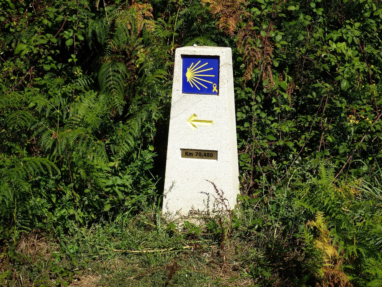
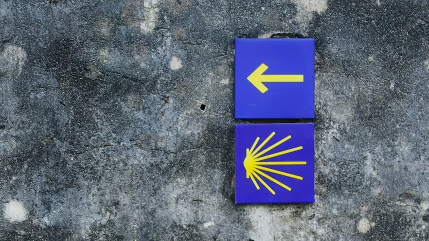
The entire Camino is perfectly marked and there will be virtually no risk of getting lost or the need to follow the GPX track on your devices.
The markers are the classic yellow signs or arrows of the Camino de Santiago:

Other routes you might like
Dingle Way
Discover the Dingle Way, a marvelous 176-kilometer walk exploring southern Ireland
West Highland Way
Discover the West Highland Way, a 154-kilometer walk in Scotland through nature and unspoiled landscapes. Get inspired by WalkingEurope!
The Via degli Dei (5 days)
Discover the Via degli Dei, visiting ancient villages and observing breathtaking landscapes on a 4-night itinerary in the Tuscan-Emilian Apennines.


0 Comments