The Finisterre Way
The Way from Santiago to Finisterre, the “end of the world”.
90 Km, 3 days | Spain
The Finisterre Way is an extension of the classic Pilgrim’s Way to the Atlantic Ocean, specifically to Finisterre, a place where ancient pilgrims probably went to collect the famous “conch shell” on the beach to testify to their journey along the Way.
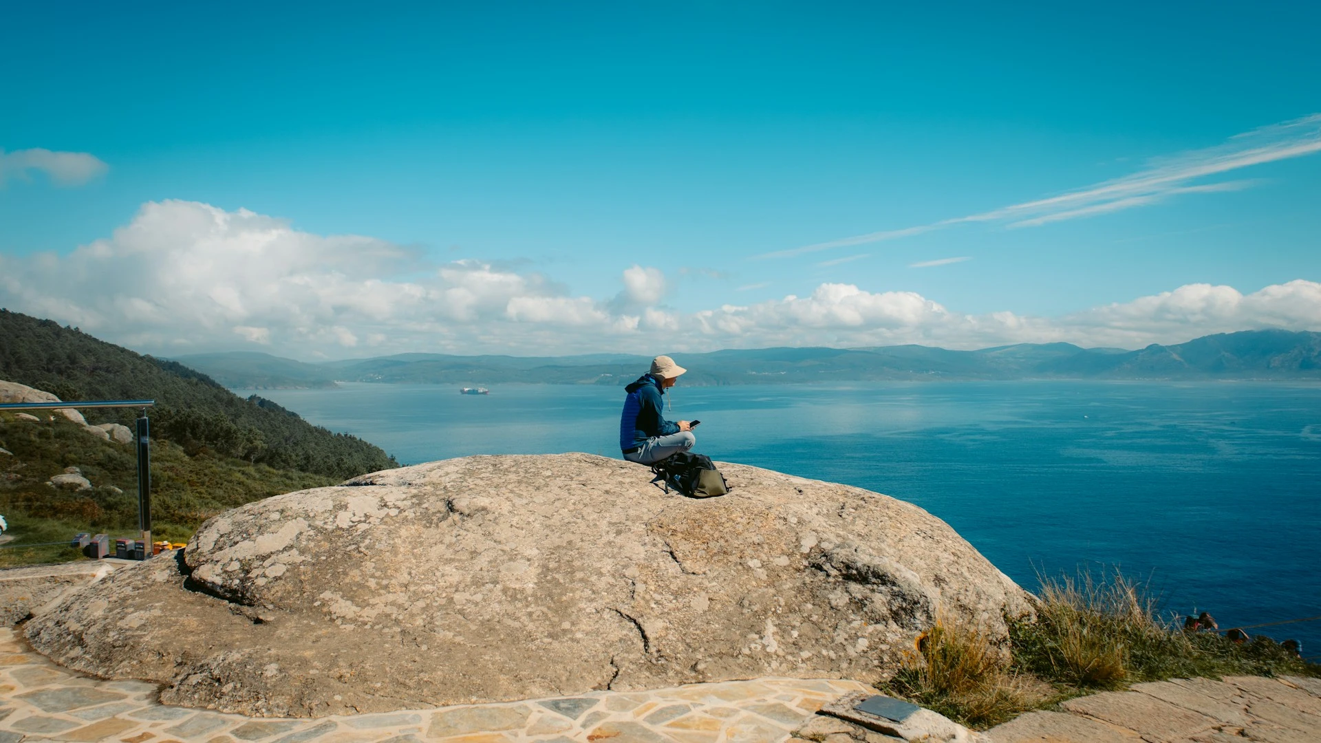
This section of the Camino de Santiago offers incredible views, allowing it to skirt the ocean for the final stretch, and is great for those who want to continue the Camino once they get to Santiago or even for those who only have a few days to walk it and capture its magic.
Transportation
As for the starting point, the Camino begins from Santiago de Compostela, which is easily reached by plane: the main airport is the Santiago-Rosalía de Castro Airport, reached by many direct flights, both from all over Europe. From the airport one can then get to the city via a bus service (at a cost of about €1-2), or otherwise take a taxi.
Santiago can also be reached by train from major Spanish cities.
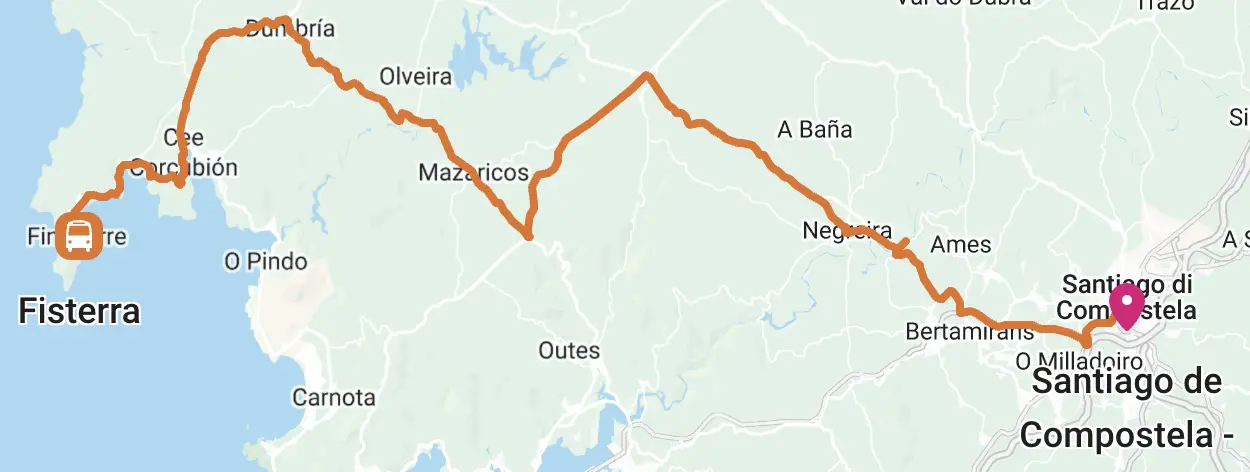
For the return from Finisterre, however, it is convenient to take a bus (average cost is €7-11) that in about three hours gets you to Santiago, from which you can then return home again by plane or train:
Click on the map above for complete route information.
Itinerary and stages
Stage 1 – Santiago to A Pena:
28 Km | 7 hours | +540m, -380m
The Finisterre Way begins at praza do Obradorio in Santiago, from where one must descend to rúa das Hortas, until arriving at rúa Campo das Hortas.
Once on this road, turn left into rùa do Pombal and continue further into rùa Campo do Cruceiro do Gaio and rúa da Poza do Bar. We then come to a small park, where, following the Camino signs, we continue down a slope, then cross a bridge and continue to the left.
At this point, the path crosses a grove and climbs slightly to Sarela do Baixo, from where there are wonderful views of Santiago and its cathedral. You still follow the road, then turn right and continue to O Carballal and again later to Quintáns.
From here we continue to follow the crossroads of the Camino and pass through a number of towns and villages, until we reach Aguapesada, from which we continue along a forest climb to the towns of Alto do Mar de Ovellas, Carballo and Trasmonte.
Continuing along the path we come to Ponte Maceira, a splendid 14th-century Gothic bridge across the rio Tambre, which should be crossed and then turned left.
Now we pass through the towns of Barca and A Chancela and shortly afterwards finally reach Negreira.
This town is the canonical stage end that is often mentioned in the guidebooks for the Finisterre Way, but, if you still have enough strength, I suggest continuing further to the town of A Pena, which is about 6/7 kilometers after Negreira, in such a way as to shorten the subsequent stages. Before you do this extension, however, make sure there is room to sleep in the albergues in Alto da Pena, as there are currently only two and in the busiest seasons you may not find room. For those who decide to continue to A Pena, the trail continues from the end of Negreira, through countryside and mostly forest, until it ends along a rise and finally arrives at A Pena.
Stage 2 – A Pena to O Logoso:
29 Km | 7 hours | +620m, -530m
Starting from A Pena, you leave the small town, following some wonderful roads immersed in the countryside and continue skirting the provincial road for a stretch and then turning right, you re-enter along the path into the countryside.
At this point continue to Maroñas and again to Santa Mariña, and then continue along the trail through the forest and through some smaller villages and towns. We then continue along a small uphill road, which leads up to a nice vantage point on the Fervenza Reservoir.
Now go downhill, until you reach the town of Lago, where you can find bars and accommodations, and continue along the main road, passing through the towns of Abeleiroas and Corzón and reaching Mallón.
From here you take the provincial road and continue on it across Ponte Olveira, which allows you to arrive shortly after in Olveiroa. There are a few albergues and places to eat here, but as with the previous stage, I suggest continuing for a few more kilometers, so as to lighten the next day’s stage (especially if you want to get all the way to the Finisterre lighthouse and not just the town). Again it is advisable to call the albergue located in O Logoso, as there are not many nearby and in case there is no room you would still have to walk quite a bit.
If one decides to continue to O Logoso, one continues following the signs of the Camino de Santiago, passing along a lovely path along the slopes of Mount O Sino and with a panoramic view of the river below, descending a little bit and then climbing back up the last stretch to arrive at the locality of O Logoso.
Stage 3 – O Logoso to the Finisterre Lighthouse:
32 Km | 8/10 hours | +500m, -700m
From O Logoso we start by crossing a beautiful forest path to Hospital, from where we continue up a small hill, but unfortunately with a view for a short distance of an ugly industrial building. Continue along the road until you come to a traffic circle, where there are two markers indicating the separation between the routes leading to Muxía and Finisterre. If you want to continue to Finisterre (this route is followed in this description), you head left and shortly after, for the first time in the entire Camino, you can catch a glimpse of the sea.
Shortly after, turn right onto a forest path, arriving at the Ermita de Nuestra Señora de las Nieves and, continuing for about 40 mintui more, you will reach the Ermita de San Pedro Martír, near which there is a spring, whose water is said to have beneficial effects for certain diseases.
You continue further into the forest and arrive at Camiños Chans, and then continue down the slope to a crossroads, where you keep going straight on the trail to Cee, a beautiful seaside town where you can find everything you need.
At this point we follow the path that winds through the city, until we reach Corcubión, another really beautiful location. From here we continue along a narrow climb through vegetation that leads to Vilar. We then follow the road and then return to the forest, and thus have a fantastic view of Estorde Beach. Now you continue to follow the path signs and pass along the main road and along the footpath, and finally reach the playa da Langosteira, an incredible ocean beach about 2 km long where, according to tradition, pilgrims take a swim upon arrival.
By now you have practically reached Finisterre, which is a few hundred meters to the left, after the end of the beach. From Finisterre, however, one can continue along a fairly steep ascent to the Lighthouse (the final destination of this walk, which is about an hour from Finisterre), where there is a sign for kilometer 0 of the Camino de Santiago and from where one can watch a breathtaking sunset overlooking the ocean.

Where to sleep
We have selected the best accommodations along the Finisterre Way, also differentiating them by price. If you book the accommodations through this section you can rest assured, the reservation will be made directly from Booking.com or Hostelworld and you will not pay anything extra, but you will help us continue the project by earning us a small percentage!
- Day 0, Santiago | Albergue Blanco
- Day 1, Alto da Pena | Albergue Alto da Pena
- Day 1 (alternativa), Negreira | Albergue Bergando
- Day 2, O Logoso | Albergue O Logoso
- Day 2 (alternative), Olveiroa | Albergue Casa Manola
- Day 3, Finisterre | Casa de Sonia
- Day 0, Santiago | Hotel Universal
- Day 1, Alto da Pena | Albergue Alto da Pena
- Day 1 (alternativa), Negreira | Albergue Bergando
- Day 2, O Logoso | Albergue O Logoso
- Day 2 (alternative), Olveiroa | Albergue Casa Manola
- Day 3, Finisterre | Hotel VIDA Finisterre Center
- Day 0, Santiago | NH Collection Santiago de Compostela
- Day 1, Alto da Pena | Albergue Alto da Pena
- Day 1 (alternativa), Negreira | Albergue Bergando
- Day 2, O Logoso | Albergue O Logoso
- Day 2 (alternative), Olveiroa | Albergue Casa Manola
- Day 3, Finisterre | Hotel O Semaforo de Fisterra
BONUS: lista completa delle strutture
Credential and Fisterrana
The Credential is the “pilgrim’s passport” and bears witness to the pilgrim’s journey, stops, and emotions; it provides access to many pilgrim welcome points and is also a fantastic keepsake to keep once the Camino is over. You can request it directly in Santiago at the Pilgrim Welcome Center, or pick it up before departure, either directly from the Brotherhood of Santiago nearest to you or from one of the authorized associations (map of associations and fraternities around the world where to apply for the credential). In Italy the benchmark is the Confraternita di San Jacopo.
Once you have completed the Way of Finisterre and have stamped your credential at the various places along the way, you can obtain the “Fisterrana“, a certificate of completion of the Camino that can be requested directly from the Albergue de Peregrinos de Fisterra!
Videos and Useful Resources
You might find it useful to watch some videos (here we have prepared a playlist of interesting videos) to find out some additional information about the Camino from Santiago to Finisterre. Click on this link to see the playlist on Youtube.
For all up-to-date information regarding the St. James Way and every aspect of it, we recommend consulting the official website of the “Oficina del Peregrino”.
Other very convenient sites for planning the itinerary are the following:
- Finisterre and Muxía Way – St. James Way in Galicia: official website (caminodesantiago.gal);
- Finisterre and Muxía Way guide: itineraries, stages, maps and kms (forwalk.org);
- Camino de Fisterra y Muxía | Gronze.com.
Guides to the Finisterre Way:
Listed below are some of what we think are the best guidebooks for the Camino; we do not think they are particularly necessary from a trail and directions standpoint, however, they obviously provide useful information and interesting trivia:
When to hike it
The Finisterre Way can be traveled year-round, paying attention, however, to the fact that Galicia is a rather rainy region and therefore, especially in the winter periods you might find rain and in some cases even snow.
You will almost always be able to find at least one albergue open at each stage, even in the winter and less busy periods, however, it is advisable, especially at such times of the year, to contact facilities in advance to be sure of finding a place to spend the night. At this link you can find a list with information and opening dates of the main facilities along the way (the file may not be up to date, so contact the albergues directly to be sure).
Depending on the season in which you wish to walk the route, you should then carefully consider your equipment and especially your shoes (in spring/summer, we recommend light, quick-drying shoes, while in winter and autumn, comfortable waterproof shoes that are also suitable for possibly muddy paths could be appropriate);
Signposting
The entire Camino is perfectly marked and there will be virtually no risk of getting lost or the need to follow the GPX track on your devices.
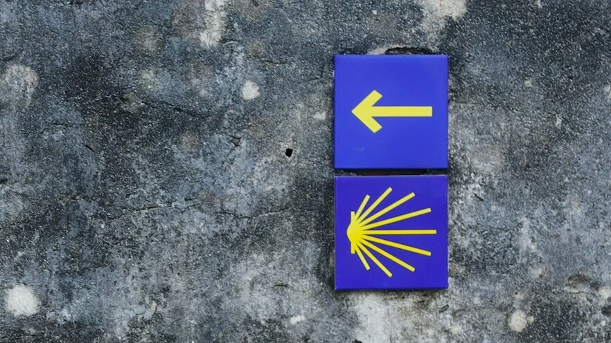
The markers are the classic yellow signs or arrows of the Camino de Santiago:
Other routes you might like
Cammino del Salento – Seaside Path
Discover the Cammino del Salento and its Via del Mare, 115 km of walking almost entirely along the coast of the Adriatic Sea
Laugavegur
Live a breathtaking experience by walking the Laugavegur, Iceland’s most famous path that will take you to discover the far north
The Via degli Dei (5 days)
Discover the Via degli Dei, visiting ancient villages and observing breathtaking landscapes on a 4-night itinerary in the Tuscan-Emilian Apennines.

0 Comments